Hikes, Bikes, and Swimming Holes
HIKES

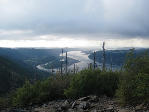
Angel’s Rest Trail: About 4.5 miles long with big, flat rocks at the top overlooking the Columbia River Gorge that are great for picnics. Connect to the Wahkeena Trail to see Wahkeena Falls or Multnomah Falls via the Larch Mountain Trail for longer hikes.
Getting there: Take exit 28/Bridal Veil from I-84 to the parking area at the intersection with the Historic Columbia River Hwy.
Forest Park: The largest urban forested park in the U.S. There are about 70 miles of trails in all, and Friends of Forest Park has a great set of maps for the best routes (get it at Powell’s).
Getting there: To avoid having to drive, take the Red Line MAX to the Zoo, and pick up the Wildwood Trail near the Hoyt Arboretum to go from Washington Park (which is worth exploring too) into Forest Park.
Eagle Creek Trail: One of the most stunning hikes in the Gorge—it’s not too steep and there are waterfalls galore. This trail is part of a larger loop but for a day hike it’s about 12 miles round-trip to the aptly named Tunnel Falls.
Getting there: Take exit 41/Eagle Creek from I-84.
Whatum Lake/Chinidere Mountain: The hike is a 4-mile loop going past the glassy lake and up to serious vistas of Mt Hood and the Gorge. Jump in the clear lake for the most refreshing swim of your life.
Getting there: Google for directions to Whatum Lake trail head; travel left around the lake; hike to Indian Springs on your left; and Chinidere is further up on the right.
Ponytail Falls/Horsetail Falls: A beautiful waterfall hike in the Gorge: not too long, and the trail goes behind the waterfalls!
Getting there: Take exit 28/Bridal Veil Falls from I-84; travel west on the scenic highway and look for the trail head sign.
Dog Mountain: This trail can be pretty steep at times, but you’re rewarded with stunning views of Mt. Hood, Mt. Adams, Mt. St. Helens and serious wild-flowers extravaganza during the summer. Take the Augsperger Mountain Trail (towards the left of the parking lot) one way to make it a 7-mile loop.
Getting there: Take exit 44/Cascade Locks from I-84; take the first right once you enter town for the Bridge of the Gods. Cross the bridge ($1 toll); turn right onto WA 14; and travel 12 miles to the trail head.
BIKES

10 miles or less—Mt. Tabor in Southeast Portland: A nice, short climb up a volcanic cinder cone, located at SE 60th & Salmon. Explore the hiking trails, hang out, bring a book, a frisbee, or picnic. Also worth checking out for a sunset or in the moonlight. Just don’t swim in the reservoirs—they store pure, unfiltered drinking water from Mt. Hood’s Bull Run watershed and are off-limits to human entry.
12-35 miles—Sauvie Island Loop: Beautiful, bucolic, flat biking with minimal traffic. Bike the 12 mile loop in either direction and take side trips down to the beaches. Warning: Collins Beach is a nudist beach! You can also check out the 3 mile Oak Island Nature Hike off Reeder Road for some great bird-watching!
20 miles or less—Lewis & Clark southbound to Oregon City: Start towards Sellwood, head south, cross the river, then north back to school. Click here for the route.
20+ miles—Springwater Corridor: The 21-mile trail begins just south of the Eastbank Esplanade (follow signs to the start), and travels alongside the Willamette for a few miles before heading east to Boring, OR. Depending on where you’re starting from, this can also be a great route to commute to school—take it to the Sellwood Bridge and head up (and we do mean UP) through the River View Cemetery, turn left on SW Palatine Hill Road, and right at the stop sign at SW Palater to reach Lewis & Clark.
30 miles—Lewis & Clark to Council Crest: A climb to the highest point in Southwest Portland. Google for directions and choose your own adventure! It’s a big climb but you can do it!
50 miles—Lewis & Clark to Canby Ferry (across the Willamette River): A pleasant 50-mile south Portland metro ride with lots of gradual climbs and a few steeper ones. The Canby ferry is free!
50+ miles—Portland to Sake Brewery: Ride out from Sellwood to Sake One in Forest Grove, the only American sake brewery! Take an afternoon tour and bike home through beautiful vineyards and luscious farmland.
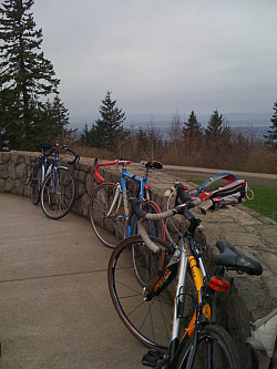
70+ miles—Portland to Crown Point in the Columbia River Gorge: This is awesome as soon as you get out of Portland. It’s about 75-80 miles round-trip from Lewis & Clark to the Vista House at Crown Point. The best way to start is around McMenamins Edgefield in Troutdale, which is also a great place to have a beer on the way home. Use google for the best bike route. You can also take the Blue Line MAX to Gresham if you want to start farther out.

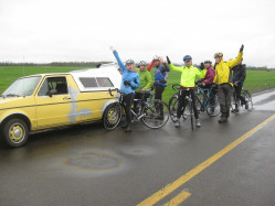
140 miles—Bike to PIELC Challenge: Join us and CATS in March to bike southbound to Eugene for the Public Interest Environmental Law Conference (PIELC). The whole thing is about 135 miles, but there will be support vehicles to carry you if your bike gets tired (which it won’t because we’ll do a few training rides beforehand). It’s definitely a challenge, but you won’t regret it. There’s lots of countryside and a very magical mountain forest towards the end. The conference is great for those interested in environmental law.
SWIMMING HOLES

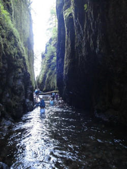
Oneanta Gorge: A magic fairy-tale chasm just east of Multnomah Falls. The half-mile trail up the river leads you to climb up and over a log jam, ending with a spectacular waterfall and swimming hole. Best on a hot day because you will certainly get wet. And don’t forget, swimming in cold water builds character.
Getting there: Take exit 28/Bridal Veil from I-84; turn left onto the Historic Columbia River Hwy; travel 5.2 miles to the parking area at Horsetail Falls.
Oxbow Park: This lovely little gem has hiking trails through ancient forests and great access to the Sandy River for kayaking, tubing, and swimming. ($5 entrance fee)
Getting there: Take exit 17 from I-84; turn right on 257th; left on Division for 5 more miles; then follow signs to the park. You can even bike there—it’s about 30 miles from downtown. Or take the Blue Line MAX to Gresham for a 12-mile ride (google for detailed directions).
Washougal River: There are tons of great swimming spots on the Washougal. You can stop almost anywhere for great swimming, but be sure to check out Dougan Falls. Don’t worry about the water being too warm.
Getting there: Take WA 14 to Washougal River Road (google for detailed directions).
Moulton Falls: This is another great place to swim in Washington, with two waterfalls and a tall arch bridge. There’s good rock jumping and you can even try jumping from the bridge if you’re feeling brave. Explore the hiking trails while you’re at it.
Getting there: 27781 NE Lucia Falls Road, Yacolt, WA (google for detailed directions).
Trillium Lake: A nice, peaceful lake with a stunning view of Mt Hood. There’s a 2 mile loop hike around the lake, with easy access to the water from much of the trail.
Getting there: Take US 26 east and turn right at a sign for Trillium Lake (about 50 miles east of I-205). At the bottom of the hill, stay straight for the day-use areas (there’s good car camping here too).
Bagby Hot Springs: A pretty amazing place super early in the morning before everyone takes it over later in the day. Brave the cold and go for a mid-finals soak to ease your stress.
Getting there: Located about 45 minutes Southeast of Estacada, Oregon. After the beautiful drive up the Clackamas River Basin on Hwy 224, turn South and follow the Collawash River. There is a parking lot and campground located at the trail head bearing the name “Bagby Trailhead.”
email elc@lclark.edu